Page 7 of 8
Re: Experiment & Questions
Posted: Fri Mar 02, 2018 4:54 pm
by Learning2Fly
kevind wrote: ↑Fri Mar 02, 2018 4:27 pm
Isn't altitude measured from MSL?
Pressure altitude, yes.
profile of altitude vs. MSL.
Re: Experiment & Questions
Posted: Fri Mar 02, 2018 5:16 pm
by kevind
Pressure altitude is the altimeter set for standard pressure of 29.92, not your actual altitude.
Looking the altitude from the earths frame of reference it will be a straight line for a constant rate climb. Looking at it from space it will be curved, matching the curvature the earth. However, if don't believe that the earth is an oblate spheroid then we will never be on the same page.
And altitude is measured from MSL so why would you want to compare altitude to MSL?
Re: Experiment & Questions
Posted: Fri Mar 02, 2018 5:54 pm
by C.W.E.
Hey smart guy, can you tell me how the VSI indicates ft/min?
No need to be insulting Learning2fly.
I learned to fly sixty five years ago, when you finally finish learning maybe you can get back to us.
Re: Experiment & Questions
Posted: Fri Mar 02, 2018 5:58 pm
by Learning2Fly
kevind wrote: ↑Fri Mar 02, 2018 5:16 pm
And altitude is measured from MSL so why would you want to compare altitude to MSL?
Sorry, I meant altitude profile using MSL values.
Re: Experiment & Questions
Posted: Sat Mar 03, 2018 3:15 pm
by Learning2Fly
There isn't much out there in NTSB land that shows a complete animation of take-off to cruise alt.
I found one animation that we can use, along with flight data.
We all agree that a green line is good; curving while ascending which indicates gravity.
If we see an altitude profile that resembles the red line, we have problems.

Without mapping any values, these two screen shots show a problem for the expected result.
The yellow bars to the left show the climb which is a straight line with respect to ground.

After the aircraft reaches cruise height, the line shows level with the ground.

If you 'add' the gravity component to climb and level flight, you would have
a climb with a curved line and cruise that drives into the ground.
If you remove it, the climb arcs upward and the cruise angles up.
Let's see what the flight data plot will show. Interesting.
Re: Experiment & Questions
Posted: Mon Mar 05, 2018 7:49 am
by Learning2Fly
Prelim results are posted. Again, I say interesting.
I think I need to use LAT/LON co-ordinates to get a more accurate total ground coverage,
but this is a decent start.
LON appears to be way off from Airport chart?
Starting elevation is 12.1 feet different from chart which I believe is within spec for flight.
KIAD - Washing Dulles
Runway 30
Elevation 287 ft.
LAT / LON = N38°56' /
W077°27'
HDG = 291
https://skyvector.com/airport/IAD/Washi ... al-Airport
AIRCRAFT
BARO = 30.21
Altitude = 275.1
LAT / LON = N38°56' /
W077°48'
HDG = 300
http://www.warrenstutt.com/NTSBFOIARequ ... index.html
DATA FILE LINE
10198 START DME 83.8
12187 END DME 68.2


Re: Experiment & Questions
Posted: Mon Mar 05, 2018 8:21 am
by Posthumane
Ok, I don't see what's surprising about what you just posted. A straight line climb with respect to the earth is the same thing as a constant climb with respect to MSL, which is a curved path looking at it from space, since both the earth and MSL are spherical (approximately). What point are you trying to make?
Re: Experiment & Questions
Posted: Mon Mar 05, 2018 8:31 am
by Learning2Fly
Posthumane wrote: ↑Mon Mar 05, 2018 8:21 am
Ok, I don't see what's surprising about what you just posted. A straight line climb with respect to the earth is the same thing as a constant climb with respect to MSL, which is a curved path looking at it from space, since both the earth and MSL are spherical (approximately). What point are you trying to make?
The point as mentioned in the previous post with the animation screen shots is:
If you account for gravity and the curvature of the Earth with the climb AND level cruise data, you end up with either of the top two scenarios (blue or green)
What we are seeing is the red line if the ground was *
cough* flat...
We want to see the green line on the lower diagram, but the data doesn't support it. What you do with the climb profile, must be done to the cruise profile.
If I'm wrong, explain.
If I'm correct, explain MORE.


Re: Experiment & Questions
Posted: Mon Mar 05, 2018 8:48 am
by Heliian
The world is shaped like a squished ball and has gravity.
Anything with a gyro is affected by gravity.
Your plane won't fly off into space due to the basic principles of flight. Lift must overcome gravity and thrust must overcome drag.
Since the world is quite large, you don't notice the corrections required to follow the curve of the earth.
Again, the world is not flat.
Re: Experiment & Questions
Posted: Mon Mar 05, 2018 8:52 am
by Learning2Fly
Two members on page 5 (Chris M., and KevinD) agreed that the climb profile should be curved with respect to gravity,
otherwise the flight instruments and control inputs don't coincide.
So now we have two pilots vs. two pilots stating different perceptions of the flight profile.
Which is it?
Chris M wrote: ↑Fri Mar 02, 2018 10:45 am
Learning2Fly wrote: ↑Fri Mar 02, 2018 10:15 amSo then your ascent is not a straight line from the tangent, it is curving down as you are climbing...but the ADI doesn't follow this trend.
Agree?
Correct. On a large scale the climb is a round profile at a constantly diverging distance from the Earth below.
Re: Experiment & Questions
Posted: Mon Mar 05, 2018 8:59 am
by North Shore
Jeebus on a bicycle! Is this still going on? And now the flat-earthers are in on it, too!

Next y'all'll be talking about variable tailwinds...
Re: Experiment & Questions
Posted: Mon Mar 05, 2018 9:10 am
by Learning2Fly
North Shore wrote: ↑Mon Mar 05, 2018 8:59 am
Jeebus on a bicycle! Is this still going on? And now the flat-earthers are in on it, too!
Next y'all'll be talking about variable tailwinds...
Yes sir, can you explain this stuff?
We have all of these expensive and accurate flight instruments plotted on a graph that do not support your member's theory of climb profiles.
These Flat Earther's have some interesting points.
You look out your window and see easily 75 miles of horizon, it's flat. Over ocean and lake especially without terrain
'distortion'. You should see 3.7 miles of curve at
the extremes of your view.

Most photos taken use fish-eye lens that naturally curve the photo.
Another good point is the Chicago skyline. This news caster says the photo is mirage. Many people have done experiments on land and on water
to prove it's not a mirage.
[youtube]
https://www.youtube.com/watch?v=vbn9BBppR5g[/youtube]
[youtube]
https://www.youtube.com/watch?v=o37t6iBS_q4[/youtube]

Re: Experiment & Questions
Posted: Mon Mar 05, 2018 9:44 am
by Chris M
Oh for **** sake... You're going to pull out that arguement? That isn't how "Seeing the curve" works.
For the sake of brevity:
Learning2Fly: Do you believe the planet is a big ball-shaped object or a big flat disc-ish thing?
Re: Experiment & Questions
Posted: Mon Mar 05, 2018 9:53 am
by Learning2Fly
Chris M wrote: ↑Mon Mar 05, 2018 9:44 am
Oh for **** sake... You're going to pull out that arguement? That isn't how "Seeing the curve" works.
For the sake of brevity:
Learning2Fly: Do you believe the planet is a big ball-shaped object or a big flat disc-ish thing?
Nevermind seeing the curve, I plotted aircraft data that doesn't agree with you.
What's your answer?
Are the instruments wrong?
Should the climb be curved, or straight?
You are contradicting your quote from page 5.
Re: Experiment & Questions
Posted: Mon Mar 05, 2018 10:09 am
by North Shore
The scientists, and a whole lot of people who are a lot smarter than me, tell me that the earth is round (Ok, oblate spheroid) so that's good enough for me.
As for the flying thing, since my first lesson, I've pushed the power in, accelerated along the runway, reached flying speed and pulled back, climbed to an appropriate altitude, levelled off, flown to my destination, pulled the power back and landed. With minor fluctuations, the airspeed and altitude have been pretty much within the parameters for the phase of flight. Again, good enough for me..
Re: Experiment & Questions
Posted: Mon Mar 05, 2018 10:15 am
by digits_
Heliian wrote: ↑Mon Mar 05, 2018 8:48 am
Since the world is quite large, you don't notice the corrections required to follow the curve of the earth.
No corrections are required to follow the curve of the earth. The plane follows a path of constant pressure and gravity. Shape of earth does not matter for that.
Re: Experiment & Questions
Posted: Mon Mar 05, 2018 10:15 am
by Tips Up
Just in response to the photo of the airliner and a pretty picture from the internet.
Most people don't realize how large the earth is compared to the altitude of a passenger aircraft hence the common pictures on flat earth websites asking why no dip seen from that altitude. Concorde's ceiling was 18 kilometres, and reports are inconsistent. Some couldn't see the curvature, even though they were looking for it. Some pilots thought they could see it. U2 pilots could generally see the curvature at 23 kilometres, and SR71 pilots could definitely see it at 26 kilometres. It's easy to think we're really high up, but comparatively we're just skimming the surface.
I realize it doesn’t answer your technical questions but those have been answered. So far in 20 yrs of actual flying with those crazy instruments I haven’t shot into space nor off the edge of the world. Nor did the SR71 guys.
The attached drawing is to scale, but the images of the jetliner and ISS are NOT to scale

- 96448E4E-A720-4DA2-A163-F623753C54B1.jpeg (87.58 KiB) Viewed 2486 times
Re: Experiment & Questions
Posted: Mon Mar 05, 2018 10:19 am
by Learning2Fly
North Shore wrote: ↑Mon Mar 05, 2018 10:09 am
The scientists, and a whole lot of people who are a lot smarter than me, tell me that the earth is round (Ok, oblate spheroid)
...
Again, good enough for me..
They tell you,
but they can't show you. Is that good enough?
Have you read the details from the beginning of this thread about gravity, the ADI, the curved climb vs. straight climb, no stick inputs vs stick inputs required?
Many things are not adding up here, and now I'm seeing a bunch of frustration in these responses after posting the graphs.
If you can't explain it, maybe what we've been told isn't accurate?
Re: Experiment & Questions
Posted: Mon Mar 05, 2018 10:26 am
by digits_
Learning2Fly wrote: ↑Mon Mar 05, 2018 10:19 am
Have you read the details from the beginning of this thread about gravity, the ADI, the curved climb vs. straight climb, no stick inputs vs stick inputs required?
Have you?
Re: Experiment & Questions
Posted: Mon Mar 05, 2018 10:27 am
by North Shore
Re: Experiment & Questions
Posted: Mon Mar 05, 2018 10:29 am
by digits_
Yeah but you see North Shore, the moon landing was fake as well, so that evidence isn't admissible

Re: Experiment & Questions
Posted: Mon Mar 05, 2018 10:31 am
by Learning2Fly
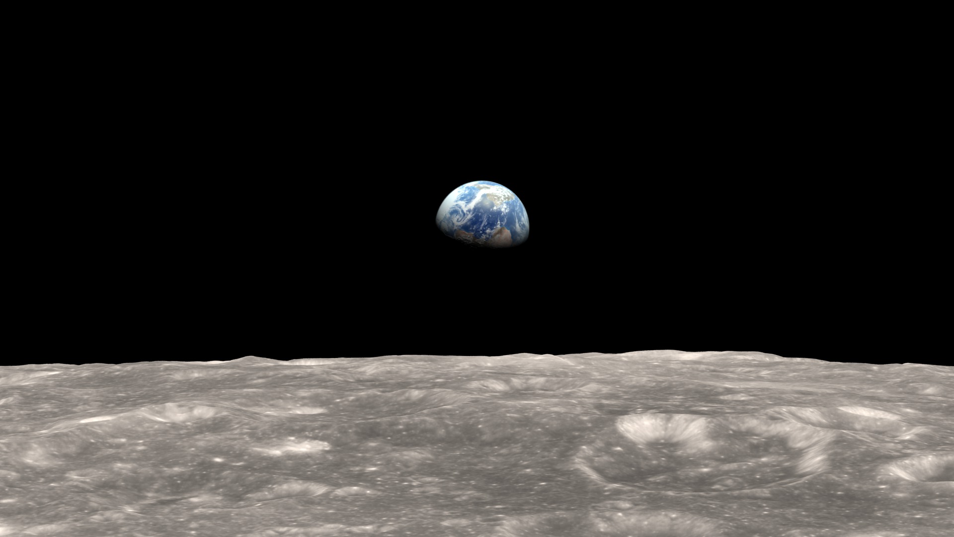
NASA has NEVER shown an image of the earth that was not CGI or composite.
It's clearly printed on their website.
By 2002, we finally had enough data to make a snap shot of the entire Earth. So we did. The hard part was creating a flat map of the Earth’s surface with four months’ of satellite data. Reto Stockli, now at the Swiss Federal Office of Meteorology and Climatology, did much of this work. Then we wrapped the flat map around a ball. My part was integrating the surface, clouds, and oceans to match people’s expectations of how Earth looks from space.
Source
https://www.nasa.gov/centers/goddard/ab ... immon.html

We have never seen an image of the Earth from space.
Cloud patterns are copied
Re: Experiment & Questions
Posted: Mon Mar 05, 2018 10:36 am
by Learning2Fly
digits_ wrote: ↑Mon Mar 05, 2018 10:26 am
Learning2Fly wrote: ↑Mon Mar 05, 2018 10:19 am
Have you read the details from the beginning of this thread about gravity, the ADI, the curved climb vs. straight climb, no stick inputs vs stick inputs required?
Have you?
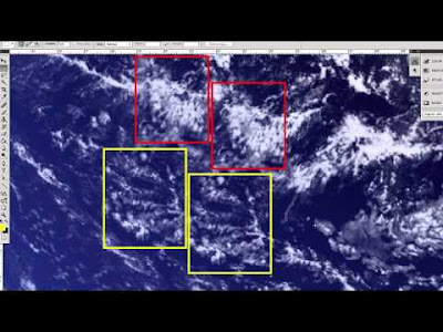
The clouds don't move in that "live feed". Clouds are ever-changing, over minutes of time.
I'll look for the time-lapse showing the identical cloud patterns.
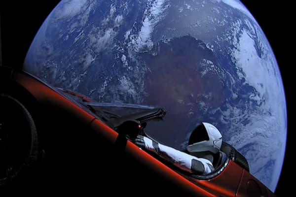
Also wondering why the car hasn't melted. Temperatures in that region of space are intense
Re: Experiment & Questions
Posted: Mon Mar 05, 2018 10:52 am
by Chris M
Well other than the fact that I never mentioned gravity in my previous response, a few screenshots of a spreadsheet aren't enough for me to agree or disagree with you. The lines you've drawn are quite useless to me as in scale at least they are grossly misrepresentative.
The spreadsheets don't appear to show anything surprising. And without knowing what you mean by "If you account for gravity and the curvature of the Earth" I'm not able to sort out your conclusions. The animation screenshots are exactly what I would expect to normally see on any "highway in the sky" type of representation.
I don't know everything. Very far from it. However, I don't live in a black and white world. The fact that I'm ignorant to something or flat out wrong doesn’t mean the flat earth video folks are correct. If you ask me what color the sky is at noon and I say "RED!", it doesn't mean that the guy that says "GREEN!" is correct. There are many far more knowledgeable people than me who've chimed in on this thread and you've either cherry-picked bits of information to obfuscate what they’ve said or used erroneous references to contradict them. These are standard behaviors of anyone looking to prove a conspiracy theory.
I would appreciate if you answer my question about what your beliefs are though, because I have a follow-up question relevant to your original question of this whole thread.
Re: Experiment & Questions
Posted: Mon Mar 05, 2018 10:58 am
by Chris M
Learning2Fly wrote: ↑Mon Mar 05, 2018 10:31 am
NASA has NEVER shown an image of the earth that was not CGI or composite.
It's clearly printed on their website.
By 2002, we finally had enough data to make a snap shot of the entire Earth. So we did. The hard part was creating a flat map of the Earth’s surface with four months’ of satellite data. Reto Stockli, now at the Swiss Federal Office of Meteorology and Climatology, did much of this work. Then we wrapped the flat map around a ball. My part was integrating the surface, clouds, and oceans to match people’s expectations of how Earth looks from space.
Thank you for re-inforcing my comment about you following typical conspiracy theorist behavior. You utterly ignore context and use a small snippet of information to back your arguement.
What about all of the Apollo mission shots of the Earth? What about the SpaceX Tesla images? No much compositing happening there....